Datasets

Open Datasets: gathered in the wild, tamed in the lab

CamelinaWeed

CamelinaWeed

Annotated UAV Imagery Dataset for Camelina sativa.

CamelinaWeed brings together field UAV imagery, orthomosaic products, and expert agronomist annotations from real Camelina sativa fields in Northern Greece. The dataset captures weeds under different seasons, locations, flight heights, sensors, and crop growth conditions, providing polygon-level labels for broad weed groups and species-level categories. It also includes raw RGB and multispectral imagery for orthomosaic reconstruction, together with ready-to-use RGB and multispectral GeoTIFF orthomosaics for field-scale analysis.

ModalityRGB UAV images, multispectral imagery, GeoTIFF orthomosaics
Scale3,023 weed-detection images • 7,890 orthomosaic-source images • RGB & MS orthomosaics
TasksWeed localization, classification, semantic/instance segmentation, orthomosaic reconstruction, field monitoring
LicenseCC BY 4.0
DroneWaste

DroneWaste

UAV imagery dataset for waste recognition in real landfill sites.

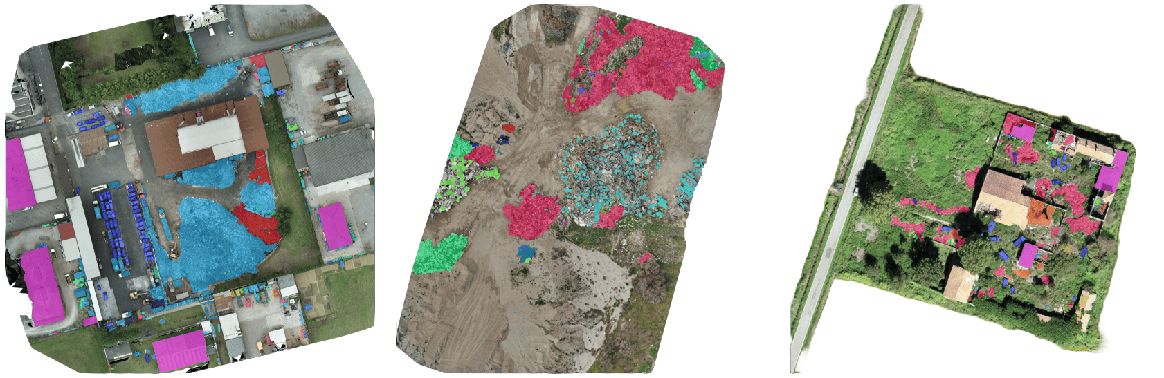
DroneWaste targets automated identification of waste materials from drone-derived orthomosaics, supporting environmental inspection workflows. Each visible waste instance is annotated with a segmentation mask, bounding box, and category mapped to the European Waste Code (EWC).

ModalityRGB aerial image tiles
Scale4,993 images • 5,135 annotations • 20 materials
TasksInstance segmentation, object detection
LicenseCC BY 4.0
CoFly-WeedDB

CoFly-WeedDB

UAV-labelled dataset for weed detection and species identification in cotton fields.

CoFly-WeedDB includes expert agronomist annotations for three common weed species (Johnson grass, field bindweed, purslane) and is suitable for training segmentation models in precision agriculture.

ModalityRGB (1280x720)
Scale201 annotated images (LabelMe) • 3 weed species
Taskssemantic segmentation, species classification
LicenseCC BY 4.0
Delivering Data

Delivering Data

Real-world last-mile pharmaceutical delivery dataset for VRP research.

A benchmark dataset built from real 3PL operations. It provides privacy-preserving matrices (no raw addresses) and richly structured constraints to test VRP solvers and learning-based routing.

ProblemCVRPTW-like daily routing instances
Scale9 daily instances • ~60-85 stops/day
DataDistance + Time matrices (optimistic/most-likely/pessimistic) + Order characteristics
LicenseCC BY 4.0
BaleUAVision

BaleUAVision

High-resolution UAV dataset for hay bale detection, segmentation, and counting.

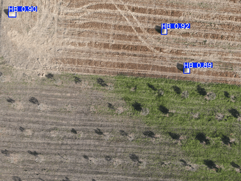
BaleUAVision provides large-scale, field-diverse aerial imagery of hay bale fields with human annotations and multiple annotation formats (COCO/YOLO/CSV/JSON/masks), plus orthomosaics to support mapping and simulation workflows.
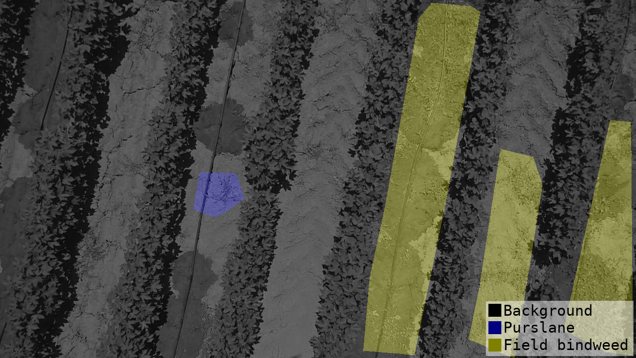
ModalityHigh-res RGB (4056x3040), geo-referenced + orthophotos
Scale2,599 images • 16 fields • ~44GB
TasksSegmentation, Detection, Counting
LicenseCC BY 4.0